

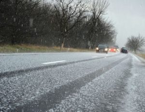
 Statewide — It may be a high of 60 degrees today, but colder air and snow will be making its way to the area later tonight into tomorrow. Meteorologists are tracking a potent cold front that has already produced snow from Montana to Iowa on Monday according to WRBI Meteorologist Mandy Thalhuber.
The storm is forecasted to progress eastward tonight. The cold air will set the stage for possible snow late Tuesday night into early Wednesday morning, though it should only be a dusting. Thalhuber said to expect the cold temperatures to stay in the area through Thursday morning.
A Freeze Warning is in effect for tonight and a Freeze Watch is currently issued for Wednesday night.
