

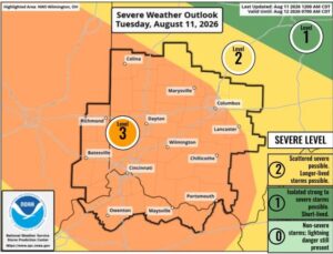
 (Southeastern IN) – Forecasters say we could see several rounds of thunderstorms today.
The National Weather Service says damaging winds and isolated tornados are possible, particularly this afternoon and evening.
In addition, a Flood Watch is in effect through 8 a.m. Wednesday for Ripley, Franklin and Dearborn counties.
Excessive runoff may result in flooding of rivers, creeks, streams, and other low-lying and flood-prone locations.
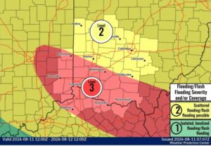 Forecasters say people in the watch area should keep an eye on the weather and be prepared to take immediate action if heavy rains and flooding occur, or a Flash Flood Warning is issued.
You’re urged to avoid low-lying areas and drivers should be careful when approaching highway dips and underpasses.